Cydonia Quest
C
Image Enhancements
C
The Cydonia Grill
This does not refer to some future Martian restaurant, but to mysterious areas on MGS images M04-01903 and M09-05394. The Cydonia web page at Malin Space Science Systems (MSSS) gives access to 40% and 100% versions of the original image strips (µµµ).
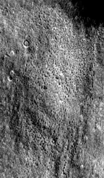
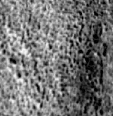
This analysis concentrates on an area of gently undulating plain that begins halfway between Bright Mounds "E" and "D" and then stretches northwards in the direction of the Rotunda and the Fort. As can be seen in the image enhancement and sample enlargement of the area given below, the ground at this location seems to have subsided in a rectilinear pattern - creating a landscape that looks like a grill cover. Even the smallest of the subsidence pits in these images is large enough to swallow a mansion. The artificiality hypothesis would suggest that the observed subsidence is caused by the roofs of large halls and tunnels collapsing. In other words, we are looking at part of an underground city that has become exposed to the Martian sky. The rest of the plain has a vague pattern of regularly spaced furrows running over the surface, which suggests that more of the surface in this area will one day subside in a similar fashion.
The Cydonia Grill is very much in keeping with the large enclosures of rubble seen in the "suburbs" to the South of the West Formation (µµµ & µµµ) and the structural detail discovered by TEM to the North of the City µµµ. Picking a safe landing spot for a spacecraft on the plains surrounding the City would not be an easy task it would seem.
The images below are taken from the anomaly rich image M04-01903 which has a resolution of 4.7 metres or about 15 feet.
C
C
C
C
C
C
C
C
C
C
C
C
C
µ Next Page
µ Return to the Enhancements page