Cydonia Quest C Testing the Arcology Model
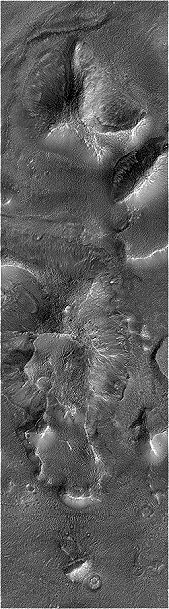
c The West Formation The West Formation forms one of the five highest points in the "City" surrounding the "City Square" mounds. Its location on a 1976 Viking context image can be seen by clicking on this "stargate" µµµ.
General description. In the Viking images the West Formation is the least compact of the formations in the Cydonia "City, stretching more than one and a half miles North to South. Before the MGS imaged the West Formation I wondered whether the bulk of the formation was a natural hill over which artificial structures had been built. The highest point on the West Formation in the Viking images is at the northern end where a rounded, four sided pyramid seems to balance incongruously on top of the rest of the formation. The 1998 MGS image confirms this impression, although it gives few reasons for thinking that the "pyramid" is an intelligent construction. It's surface is fractured into huge blocks, but such erosional patterns are not unusual in nature. The West Formation does share an intriguing common feature with the East Formation. In both cases their highest point co-incides with a cairn like feature. This may be significant as Robert Fiertek has observed that the five highest points in the "City" surrounding the "City Square" appear to form a symmetrical (but not a regular) pentagon. C
c The second feature of interest in the Viking images was at the southern end of the West Formation where a wall enclosed a large "courtyard". The MGS has revealed this to be a very interesting place indeed with a collection of straight, light coloured ridge features reminiscent of causeways. Most interesting of all is that these features are associated with what appears to be a ruined pyramid, comparable in size with the Great Pyramid at Giza. As this series of articles is concerned with finding evidence of what lies at the hearts of the bigger Cydonian formations a proper review of these particular surface features will be covered elsewhere in the Mars pages. However, in the meantime here is a link to a Mike Bara analysis of the relevant area µµµ.c ccccccccc
C Possible subsidence features in the West Formation
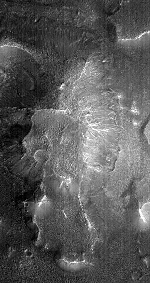
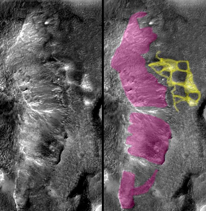
In the Viking images of the West Formation, the eastern side was in deep shadow. The newer MGS image reveals much that may indicate the collapse of this side of the West Formation into a long North-South "chamber". This hypothesis is shown in the main illustration below.
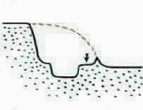
East side story. In the illustration below the parts of the eastern side that I think are showing signs of inward subsidence (or actual collapse) have been coloured in pink. Of the three areas thus shown it is the bottom most and central ones that are most interesting. In both these cases there are areas within them that have subsided below the general level of the ground surrounding the West Formation. The southern most zone of subsidence actually runs off the bottom of the picture, but it is noticeable that its outer edge is always straight and parallel with the straight "causeway" feature on its inner edge. However, it is the central area of proposed subsidence that is most interesting. I've already had a good moan about the murkiness of this image in the previous article on the North Formation - but with a little contrast enhancement on the full sized image it is possible to draw the West-East cross section in the diagram (right). I've marked where I think the original surface of the West Formation was with the dotted line. This original outer edge of the formation is still marked by a thin wall. Then as we move inward we come to a pit, which may be the result of everything that was once above it collapsing into the "basement". In a full sized, contrast adjusted image of this pit there are bright, long, streaks of rock running down into it from the ledge arrowed in the diagram. These seem similar to features that TEM have identified as the remains of possible support arches in the "Main Pyramid" (click here to access relevant TEM article µµµ). (To access a full sized JPL processed image of the West Formation then click here µµµ). c
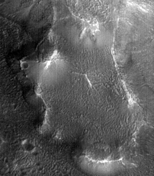
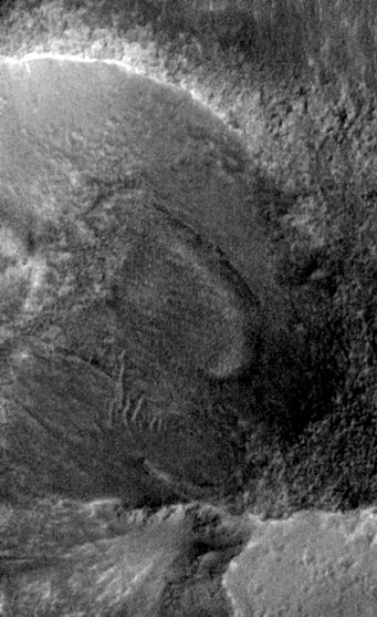
c Other features of interest. In the Viking images the northern end of the West Formation has a vague connection to a three sided hill to the West of it. Although this hill has not been imaged by the MGS, it can be seen in the context image that two narrow ridges run towards its location from the West Formation. These ridges seem to enclose an "amphitheatre" shaped depression which has a straight outline on its southern edge, but a circular one elsewhere. This could be an architectural feature, or it could even be the result of the collapse of an internal chamber. It would be useful to have an image of the whole thing, including the adjacent hill to the West. There are many fissures within the "amphitheatre". One of these surrounds an oval shaped plate of material that has detached itself from higher up the slope (see cropped image below). c cccccccccccccccccccccccccccc
c Although they are not strictly subsidence features, I have drawn attention to the grid like pattern to the East of the West Formation in the main coloured illustration above. This grid has been observed on other Cydonia websites and involves an array of interconnected mounds and hollows. I've used yellow to colour in the mounds, the connections between the mounds, and the edges of the hollows. The overall effect looks quite rectilinear - almost like the buried remains of an archaeological site. Of course, because the image is very hazy I may have been suffering from Percival Lowell syndrome when I outlined these features, but they are interesting none-the-less.
µ Next page µ Return to the main Arcology page
|