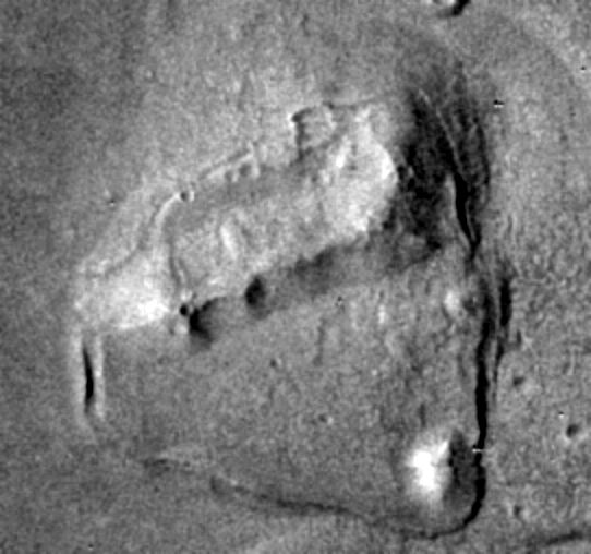
 Cydonia Quest C Image Enhancements C c The "Island Fort" at Higher Resolution One of the interesting discoveries made in Cydonia by the low resolution THEMIS camera of the 2001 Mars Odyssey has been the "Island Fort" formation. This is shown enhanced and enlarged by a factor of two in the illustration below, which also shows the low island-like "platform" on which it sits . A fuller exploration of why this formation is so interesting can be found in an earlier Cydonia Quest article at the other end of this "stargate" µµµ. Basically, the "Island Fort" is a broadly rectangular shaped hill whose interior appears to have collapsed inwards. Given the shape and the apparent implosion of this formation it is a strong candidate as a possible artificial structure in which the interior chambers have caved-in. |
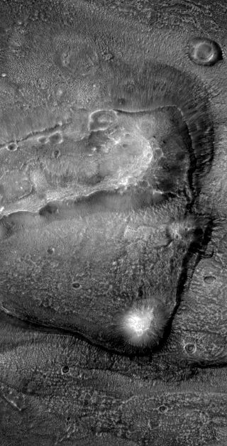
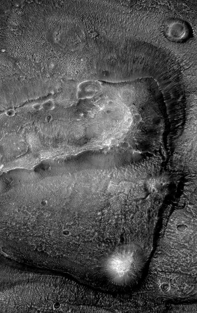
| C cccccccccccc ccccccccccccccccccccccccccc c Most of the "Island Fort" formation has now been captured at a higher resolution in an image released in the latest Autumn image "dump" from the Mars Global Surveyor. The second illustration above shows the "Island Fort" and its surroundings from this new image reduced by 50% for comparison with the Mars Odyssey picture. The MGS source image can be viewed by clicking on this "stargate" µµµ. A full sized and slightly enhanced version of the image can be seen below. The resolution is 4.9 metres (around 15 feet) per screen pixel - or a third as good as the MGS's MOC camera is capable of. c
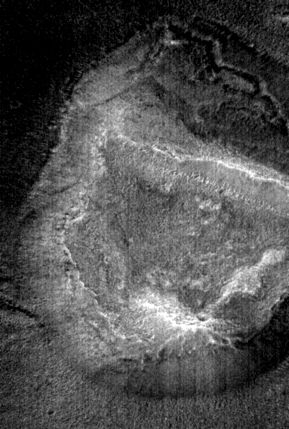
c The impression gained by the author from this higher resolution image is that the trough in the centre of the "Island Fort" is a collapse feature and not a hollow scoured out by wind erosion. (The reader will have to decide for themselves on this. A collapse is consistent with the artificiality hypothesis and that this is the possible ruin of a super habitation - an "arcology"). There seems to be a honeycombe/cellular appearance to the high ground at the eastern (right hand) end of the "Island Fort". This may be the outlines of rubble filled "rooms" exposed by the removal of outer layers by erosion. It would be interesting to see what this would look like at MGS's highest imaging resolution of 1.4 metres (around 5 feet) per pixel. Theoretically this highest imaging resolution should collect nine times as much information per unit area of land as that used for taking the image we are examining here. The number of larger holes on the Island Fort's "ramparts" also seems to be much greater than the normal density of impact craters in this particular image strip would allow. Perhaps some of these holes are actually smaller scale versions of the much bigger collapse that fills the whole centre of the "Island Fort". There are other anomalous looking features around the "Island Fort" itself, but the reader has probably spotted these for themselves. Formations with apparently caved-in sides or centres are a common feature of Cydonia. In some ways the "Island Fort" shares some common characteristics with the "Collapsed Mesa" (see µµµ), a reduced image for which is shown below. C ccccccccccccccccccccccccccccccc C µ Return to the Enhancements page
|
