Cydonia Quest C D&M Pyramid - Examining the "Girders" C Part Three C
This page contains some very large images. Readers are advised to view this page in "full screen" mode to fit more of each image onto the screen at the same time. Press the F11 key to enter "full screen" and then F11 again to return to the normal browser view.
Some readers will also benefit by increasing their browser "zoom" by an increment - hold down the control key (Ctrl) and press the plus key (+). To return to standard zoom hold down the control key and press the minus key (-). For tips about adjusting the appearance of your browser display click here.
Viewing the images in low lighting conditions also makes details easier to see.
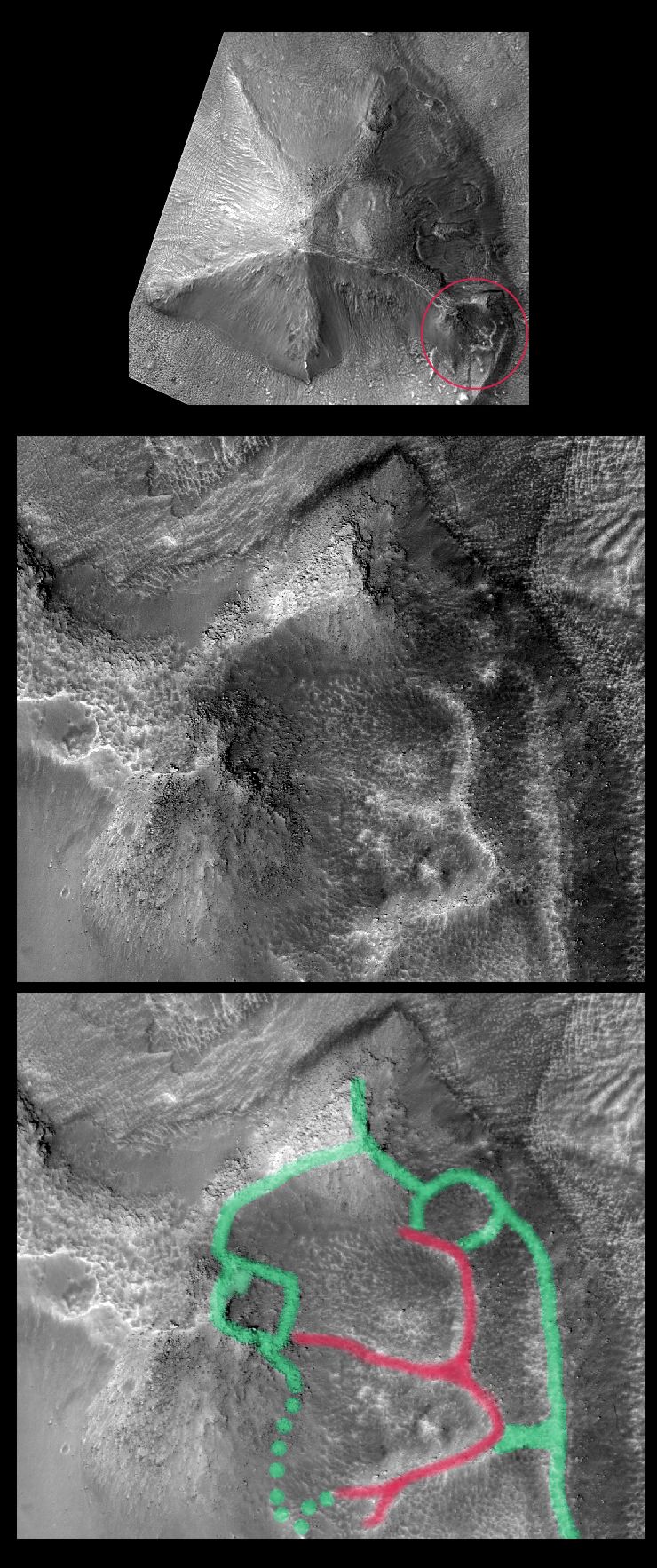
C The collapsed satellite mound
Many of the proposed arcologies at Cydonia have one or more satellite mounds attached to them. This is also the case with the five sided D&M Pyramid. There are the remains of such a mound centred on its eastern-most corner. The D&M's satellite is particularly interesting because it appears to have long ago collapsed into an artificially hollow interior. This collapse has left behind the stumps of major structural walls/partitions that once supported this smaller suspected arcology. The last image in the display below attempts to trace out the higher parts of this apparent ruined structure. For the most part the inner walls, traced in red, are more prominent than the outer features traced in green.
Viewing the 3D stereo image of the D&M with my cardboard blue/red glasses helped greatly with tracing the external and internal features of its collapsed satellite mound (see µµµ).
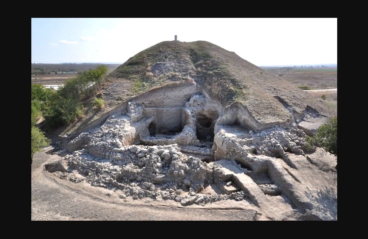
The next image is an earthly archaeological analogue for the D&M's collapsed satellite mound. It shows a large mound at Solnitsata near Provadia in Bulgaria that hides the remains of a fortified citadel. Solnitsata is claimed to be the site of Europe's oldest town (µµµ). Partial excavation of this mound has revealed the stumps of the internal walls and hollows where rooms used to be. These exposed structural features have an appearance that is very similar to what we see in the D&M's collapsed satellite mound. So the D&M's satellite mound at least looks like some type of ruin, even if we can't verify this yet.
The D&M's highest parts
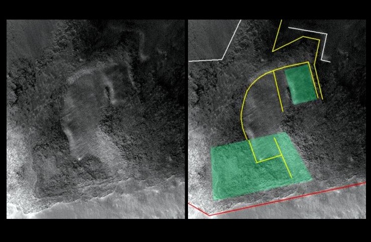
Previous analysis of the D&M Pyramid (using earlier imagery from the Mars Odyssey and Mars Global Surveyor orbiters) has commented upon the unusual depression at the top of its eastern facet. the southern part of this depression comprises a sub-depression of a roughly trapezium shape. Around 80% of the boundary of this shape is marked out by a downward shear in the D&M surface. Another oblong feature to be seen in the image is a raised platform surrounded by rough, raised surfaces on most sides. Both these features are shaded schematically in green in the illustration below. This illustration also has a number of lines drawn on it indicating edges, where smooth areas meet rough areas, and the general trend of some shallow furrows. (All of this diagrammatic "annotation" is schematic only, as my mouse drawing abilities deserted me with this diagram).
There are reasons to believe that this depression has been caused by subsidence. In the arcology model this subsidence would be explained by the collapse of a geometrically shaped volume of artificial space deep within the D&M. The geometrical shape of this collapse would then be transferred up to the surface in an hour glass fashion.
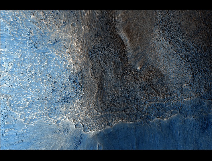
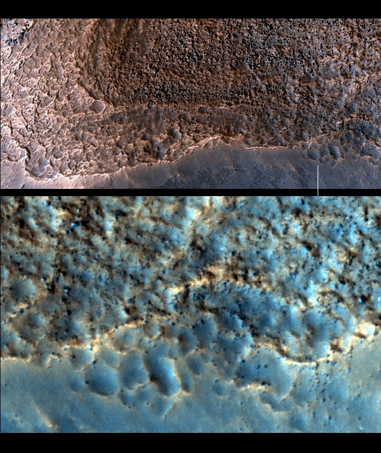
The higher resolution imagery of the MRO orbiter includes a narrow false-colour strip down the centre of each image. The illustration below is a closer MRO view of the trapezium shaped hollow. It can be seen that the surfaces around this hollow and the D&M's peak have the same cellular appearance seen in Part 2 of this article.
The next illustration zooms into part of the previous image. The second image in the illustration is at full resolution and straddles an area with a width of about 740 feet. It can be seen that the cellular pits near the D&M's summit are choked with rubble and windblown dust.
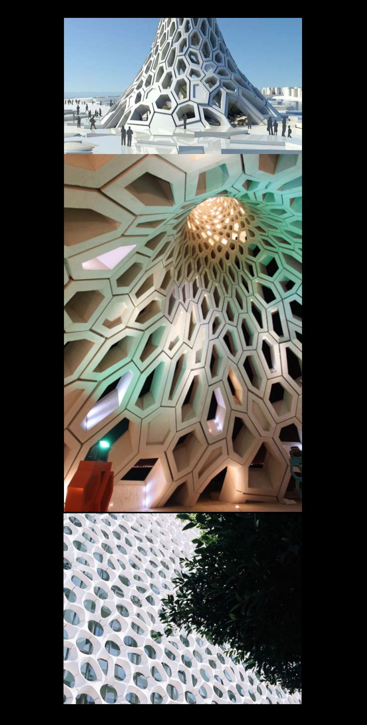
Part 2 ended with a pictorial example of how modern human architects are abandoning rigid right-angled and four sided structural grids in buildings for more geometrically random arrangements. We can imagine that if such structures were to suffer sandblasting erosion their ruins would end up looking rather natural and tafoni-like. We'll end Part 3 with some more examples of such crazy modern structures.
Click the links below to continue reading this article.
µ Back to Part 1 µ Back to Part 2 µ Forward to Part 4 µ Forward to Part 5 µ Back to the Mars Page µ Back to Cydonia Quest Main Page C
|