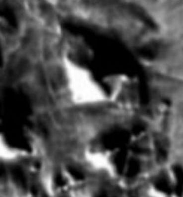
 Cydonia Quest C Image Enhancements C Further Experimental Analysis of the First Infra-red Image of Cydonia Part Three C C Part Three is devoted to the geometric looking infra-red (IR) features to be found around the D&M Pyramid and the large hill just to the south of it in the Cydonia daytime IR release of the 24th July 2002. The area of study is shown in this full sized illustration taken from the Mars Odyssey visible light image of the D&M and "Face". C cccccccccccccccc C The resolution of Mars Odyssey's visible light camera is five times greater than its THEMIS infra-red imaging system. The visible light image (below left) has been reduced by half and the daytime IR image (below right) has been enlarged so that the two can be compared. It may be a case of the disparity in resolution, but the IR appearance of the land to the south and east of the large hill below the D&M has a much more geometric appearance than it does in visible light. If we adopt the artificiality hypothesis then the companion hill to the D&M may be the remains of a much larger structure or complex that has suffered a catastrophic collapse. The various IR "enclosures" that adjoin this hill may therefore actually represent the remains of actual retaining walls encased by rubble filled voids in the ground.
|
| C
c The D&M Pyramid itself has a remarkable geometry which has been dealt with elsewhere on this website, (click next "stargate" for details µµµ). Although I still have strong reservations about its total accuracy (µµµ), I'm still using the leaked so-called "real" version of the July daytime IR image as a guide to where to look for IR grid patterns in flatter areas of ground. De-correlation stretch images derived from the "real" IR image show a grid pattern around the southern and western sides of the D&M which looks worth investigating in the official version. In the two images below the official daytime IR data has been ultra-contrast enhanced and given a very slight BUMP map treatment to accentuate lighter features in the image. (Note: strong BUMP mapping does not work very well on hills because their shadowed sides get converted into pits in the ground!). It can be seen that there is indeed a geometric thermal grid in the zones predicted by the "real" IR image. (I've almost given up describing the "real" IR image as "authentic" or a "fake". The term I use now is "useful"as it has pointed me in directions of investigation of the official images that I would not otherwise have undertaken). C
ccccccccccccccccccccccccc ccccccccccccccccccccccccc C As usual it is best to view such blurry images well back from one's computer screen to see the best effect. There is certainly a sense in the enhanced IR images of the area that the remnants of artificial constructs may be buried in the ground around the D&M and its near neighbour. What the IR data is probably picking up is slight undulations in the ground, perhaps differences in surface mineral composition, and perhaps parts of the ground that just get warmer in the Sun because of their intrinsic material properties. It would be useful if the THEMIS imaging team at ASU could be persuaded to take a visible light image of the Cydonia plains when the Sun is casting very long shadows. The patterns of gentle undulations in the ground that could then be seen could throw up many surprises. In the image below I have taken the image above left and given it a green tint, then enlarged it before overlaying it as a transparency over the visible image of the area that this web page began with. The effect is quite interesting. ccccccccccc c µ Return to Part 1 µ Return to Part 2 µ Forward to Part 4 µ Return to the Enhancements page
|