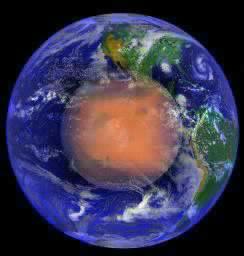
 Cydonia Quest C Image Enhancements C c The First MOC Images of the D&M Pyramid Part Three The D&M Pyramid's Suburbs. After the Mars Odyssey spacecraft captured the best ever (but low resolution) image of the D&M Pyramid in 2002 I became convinced that higher resolution imagery would reveal it to be surrounded by the Cydonia landscape type known as "suburbs". This was because the area surrounding the D&M seemed to share characteristics with other areas where "suburbs" had been previously found in the high resolution imagery of the Mars Global Surveyor (MGS). This hunch has proved to be correct with vast swathes of "suburbs" to be seen surrounding the D&M, especially on its western side.
|
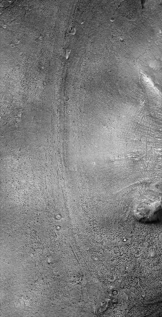
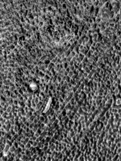
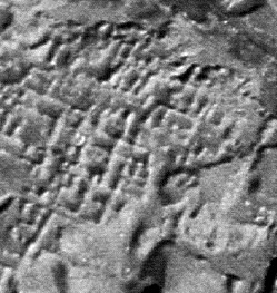
The next image shows the "suburbs" lying to the west of the D&M reduced in scale by 50%. (The western corners of the D&M Pyramid can just be seen on the right of the picture). A full scale and contrast enhanced version of the MGS image strip it came from can be seen by clicking this "stargate" µµµ. C ccccccccccccc As always with these outsized images the reader is advised to use the "View" then "Full Screen" options from the menu bar at the top of their browser screens to see the images more clearly. c The "suburb" areas are comprised of lace like patterns of walls surrounding enclosed areas the scale of sizeable buildings. Analysis of other "suburb" areas suggests that they are due to subsidence caused by the collapse of pre-existing voids under the ground. Typically, these areas show progression from a few randomly arranged pits in the ground, to artificial looking grids of rectangular shaped pits, and then degrade into areas where some of the walls between pits erode away leaving a more natural looking effect. So far only one section of "suburb" landscape has been imaged at the MGS's highest resolution. The illustration below shows a sample of this image strip at full resolution. C ccccccccccccccccccccccc cccccccccccccccccccccccccccccccccc C Many parts of this area of "suburbs" compare favourably in appearance with the aerial view of the buried ruins of the ancient Assyrian city of Assur shown in the second illustration above. If the "suburbs" do have an artificial origin then it is the Cydonia Quest theory that they represent a kind of horizontal arcology. That is to say they are the subsidence depressions left over from the collapse of an underground city tunnelled out just below the Cydonia surface. Where the roofs of these artificial and geometrically shaped caverns collapse we are left with "suburb" landscapes. If this is true then we may only be seeing the top layer of this underground city. Transport and service tunnels could be running deeper below the layer we can see.
|
The following illustration shows the main areas where the MGS has located "suburbs" in relation to the "Face" (at top right), the City (at left centre) and the D&M Pyramid (near lower right). However, as the MGS's coverage of the areas away from these features is very limited it is possible that the "suburb" areas shown represent just parts of a single entity. The red area shows the position of the D&M suburbs covered on this page. The green area shows the "Grill" area (see µµµ & µµµ) and the blue area the "Southern Suburbs" (see µµµ & µµµ). C ccccccccccccccccccccccccccc C It can be tempting to dismiss the "suburbs" as some weird natural Martian landscape - (there appears to be nothing quite like them on Earth) - due to the fact that some "suburb" areas appear formless rather than geometric. This temptation is equally as seductive to us when viewing the cellular patterns exposed on the surfaces of ruined arcology candidates such as the D&M itself. However, collapse and uneven erosion are the enemy of the geometry of constructed things. As an example, from an objective standpoint there is little reason to think that the ruins of the Chinese city of Gaochang using the image seen below are artificial. Even where erosion has exposed hidden rooms the openings into them are natural and cave-like. If this was on Mars without the grass, people and other obvious give-aways, then it would be easy to dismiss this scene as a badlands landscape with wind excavated caves. Ruins just aren't tidy and obvious. That's why lost cities keep turning up even in Earth's easy to survey arid, defoliated areas. C cccccccccccccccccccccccccccc µ Back to Part 1 µ Back to Part 2 µ Forward to Part 4 C µ Return to the Enhancements page µ Return to the main Mars page
|

